Pars-I Remote Sensing Satellite: In a military advancement, Iran launched a Pars-I Remote Sensing Satellite using a Russian Soyuz-2.1b rocket located in Russia’s Far Eastern Amur region bordering China. Iranian state media broadcasted the lift-off live nationwide. This 50-kg satellite, developed by the Iranian Space Agency (ISA), will be employed including agricultural monitoring, natural resource mapping, water management, and disaster response planning, according to officials.
Pars-I Remote Sensing Satellite
Pars-I Remote Sensing Satellite
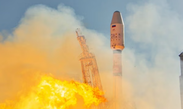
The Pars 1 remote sensing and imaging satellite was launched on Thursday by a Russian Soyuz rocket from the Vostochny Cosmodrome and will scan Iran’s topography from an orbit of 310 miles (500km). Pars-I has expected an active lifetime of over a year, where they had specialist equipment like multispectral cameras that can capture high-resolution imagery with multiple sensor bands from orbit capturing electromagnetic radiation across multiple wavelength bands, providing data for various applications such as land cover analysis and environmental monitoring., nearly a week after the launch of a research satellite by its Islamic Revolutionary Guard Corps (IRGC). A near-Earth orbit typically ranges from 160 to 2,000 kilometres above the Earth’s surface. Satellites in LEO orbit the Earth relatively quickly, enabling frequent passes over different areas.
Who launched the Pars-I Remote Sensing Satellite?
Iran launched the Pars-I Remote Sensing Satellite
- Sonu Bidde Of TMKOC Nidhi Bhanushali will make a comeback after 5 years of escape from entertainment in Sisterhood
- Actor Ritesh Deshmukh starrer Pill Trailer out: He Vs Plague
- Kangana Ranaut’s Directorial Historical on India’s first woman Prime Minister, Indira Gandhi To Be Released on 6 September 2024
- Warner Bros Animation Released the Trailer Of Batman: Caped Crusader
- Funny and Insightful Couple Romantic video


Add comment